A wetland refuge on the Russia-Mongolia border
The Landscapes of Dauria is a UNESCO site home to some of Inner Asia’s most charismatic wildlife, but is threatened by Mongolia’s Blue Horse programme of water infrastructure projects
Eugene Simonov The Third Pole. June 8, 2021
Editor’s note: This is the second in a two-part series on Mongolia’s Blue Horse water infrastructure programme. Read the first article here
The ever-changing Torey Lakes are a wetland paradise. Two large lakes and more than 300 smaller bodies of water in the Torey Depression support 305 bird species and 42 mammal species, as well as reptiles, amphibians, fish and more than 590 species of insects. Many of these are rare and threatened, and endemic to the region. Located in Russia, on the border of eastern Mongolia, the lakes are an important stopover point for migratory birds.
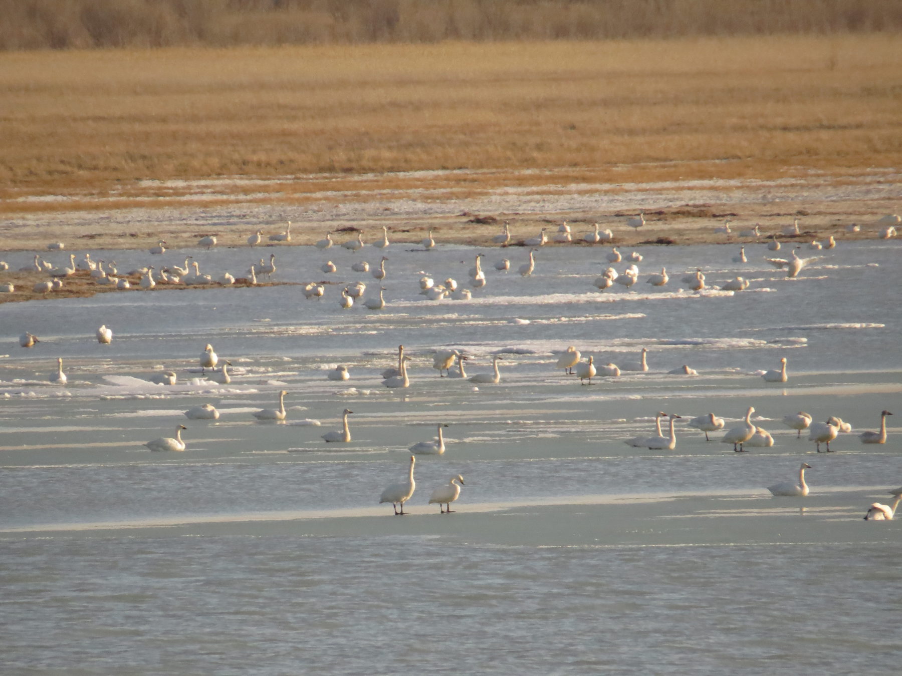
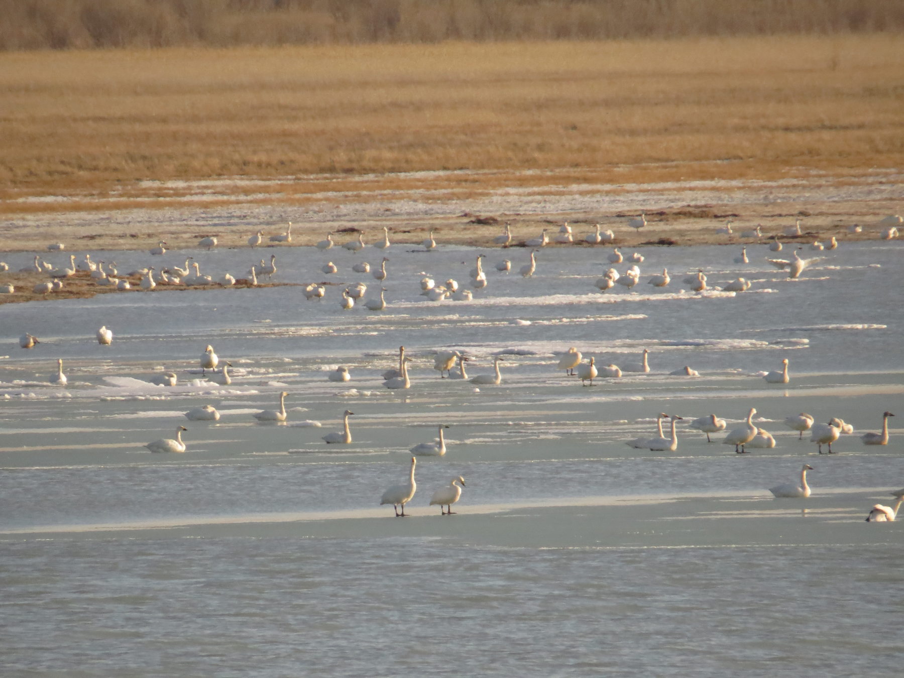
Tundra swans rest and feed at Ukshinda Lake in the Torey Depression during their northward migration to their nesting grounds. The wetlands of the Landscapes of Dauria are resting grounds along the East Asian-Australasian Flyway. There are up to 3 million migratory birds here in spring and 6 million in autumn (Image: Oleg Goroshko)
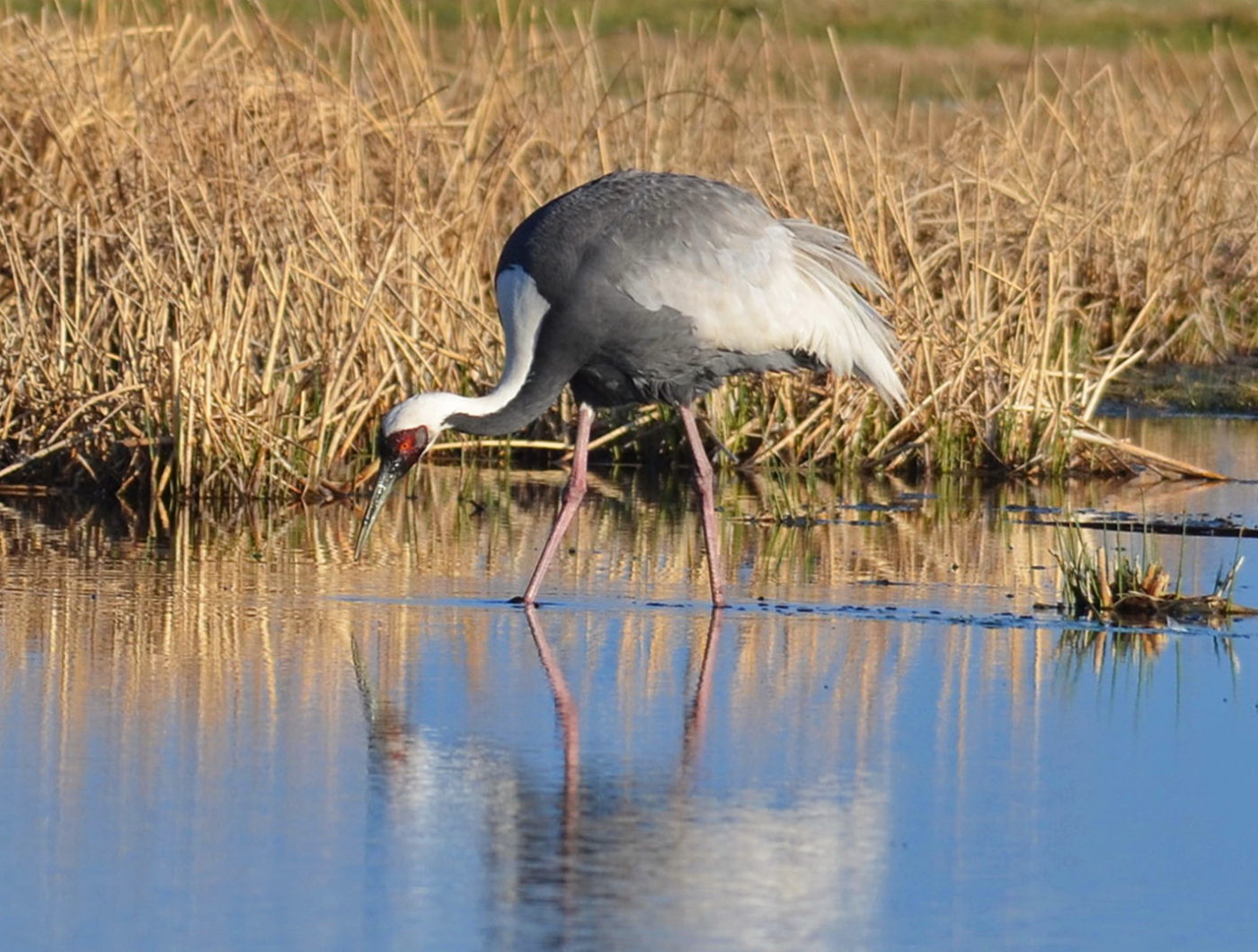
A male white-naped crane feeds near its nest at Lebedinoe Lake, a small steppe water body in the Torey Depression. With less than 8,000 individuals the species is classified as vulnerable, mainly due to the loss of wetlands. This makes the Torey Lakes an important nesting place (Image: Oleg Goroshko)
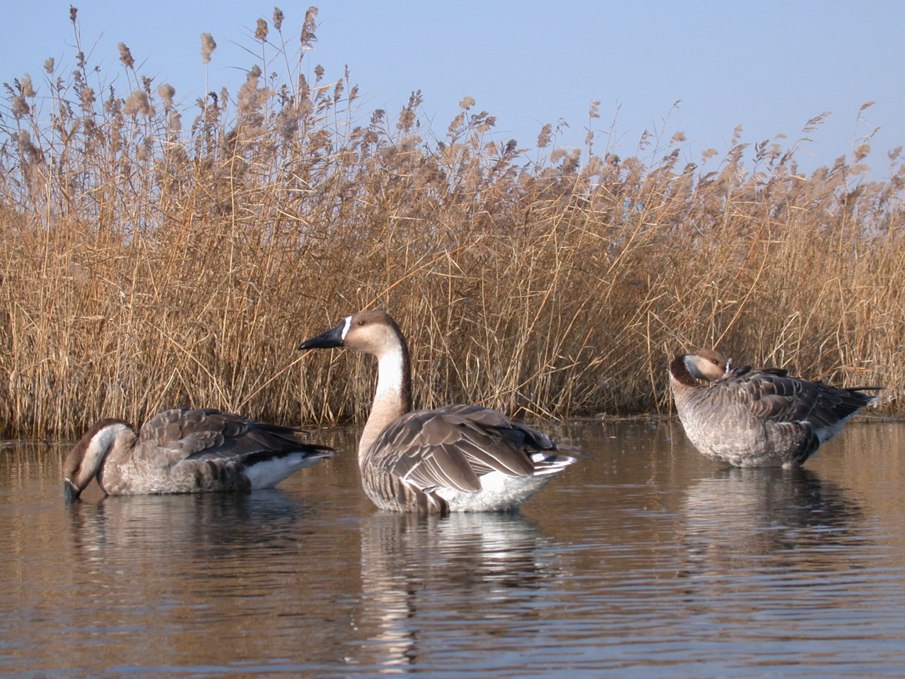
Rare migratory swan geese feed at their breeding habitats on the lower Ulz river. They return to Mongolia, northern China, and southeast Russia in April for the breeding season (Image: Oleg Goroshko)
The Torey Lakes are the core of the Landscapes of Dauria, a transboundary area that straddles Russia and Mongolia. In 2017 it was listed as a UNESCO World Heritage Site, as “an outstanding example of the Daurian steppe ecosystem”. Covering more than 9,000 square kilometres, its steppe landscapes are connected by the tiny Ulz river, which sustains the wetlands and lakes.
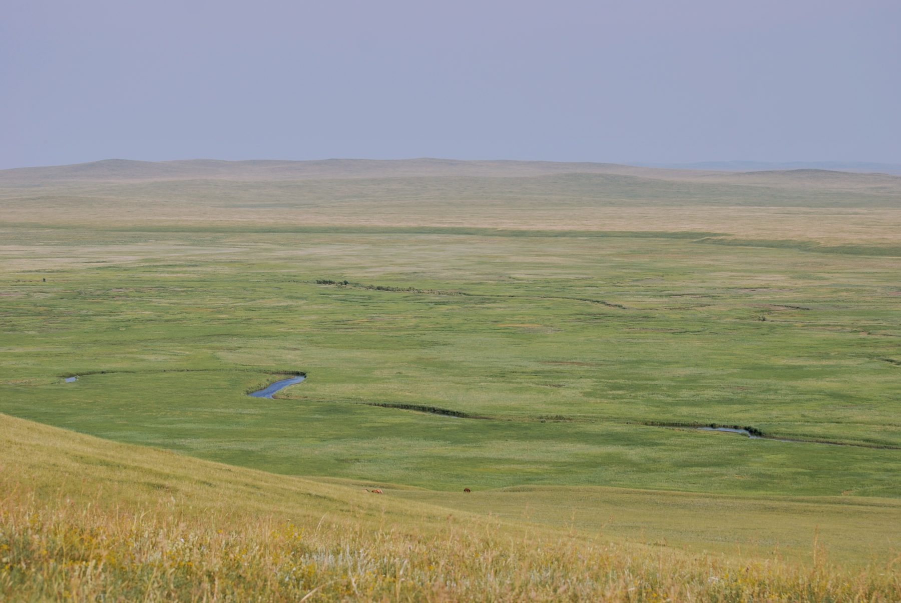
View of the Ulz river from the Eltrud hills, a section of the Dornod Mongol Strictly Protected Area in eastern Mongolia (Image: Vadim Kiriliuk)
Drought and deluge
The Dauria steppe has distinct wet and dry periods. Every 25-40 years the Ulz river floods and fills the Torey Lakes. Then, over years, the lakes dry until they are again replenished. This force shapes the ecosystems and people of the region.
At the peak of the wet phase, thousands of ephemeral lakes appear across the steppe. The flood waters trigger a new cycle of life and provide habitat for a huge diversity of life.
Smaller, more frequent floods sustain core areas. The most stable floodplain wetlands of Dauria are life-support systems for wildlife and humans through all phases of the climate cycle. The last filling of the Torey Lakes by the Ulz started in autumn 2020.
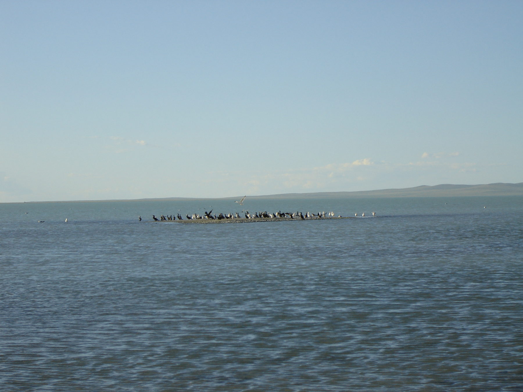
Waterbirds at Zun-Torey Lake in summer 2006, come to feed from neighbouring Barun-Torey Lake. The lake was at the beginning of the drying stage but the water level was still high. Zun-Torey is in the Russian part of the Landscapes of Dauria (Image: Tatiana Tkachuk)
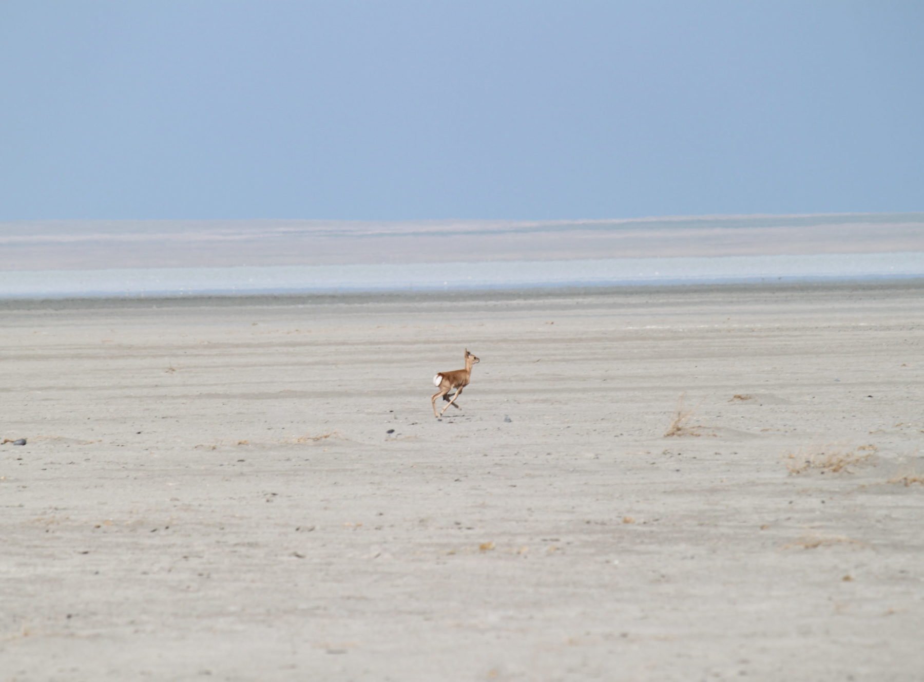
In the same place in summer 2017, a young Mongolian gazelle runs across the dry bottom of Zun-Torey lake. Gazelle come to the bottom of the Torey lakes to feed on grass and to rest, as the wet ground is cooler. In 2017 there was a shallow pool of water left at Zun-Torey; by the following year it had dried up completely (Image: Tatiana Tkachuk)
During the dry phase all small rivers, most of the springs and up to 98% of lakes disappear. The Torey Lakes take about two decades to dry up completely, and are filled again by Ulz river floods after several consecutive high-water years. These ‘pulsating’ water bodies create a dynamic mosaic of habitats rich in biodiversity. Wildlife migrates and changes with the fluctuating landscape.
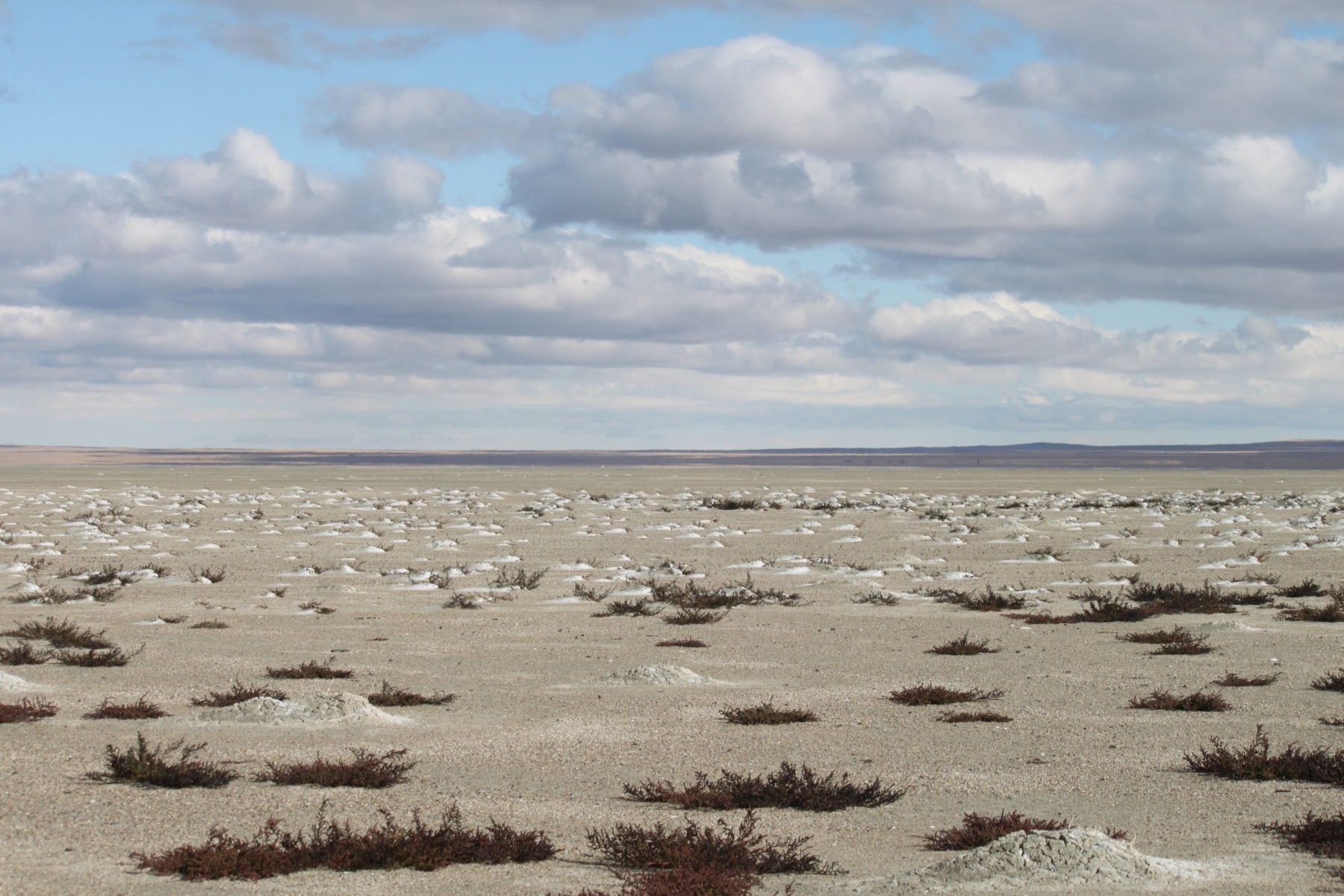
The dry bottom of Zun-Torey lake in late autumn 2020. This area of the lake dried up about three years ago. Mineralised groundwater is still close to the surface, and when it evaporates it leaves behind a white crust of salts. The only plant species still growing here is adapted to saline or alkaline soil (Image: Tatiana Tkachuk)

Dead silver carp on the shore of Zun-Torey lake in 2004, at the onset of another drought. Every 25-40 years the Torey lakes shrink and salinity levels exceed what the fish can tolerate. The fish die en masse until the next wet period. Local people are encouraged to fish in the buffer zone of the Landscapes of Dauria to make the most of this rare bounty. (Image: Oleg Korsun)
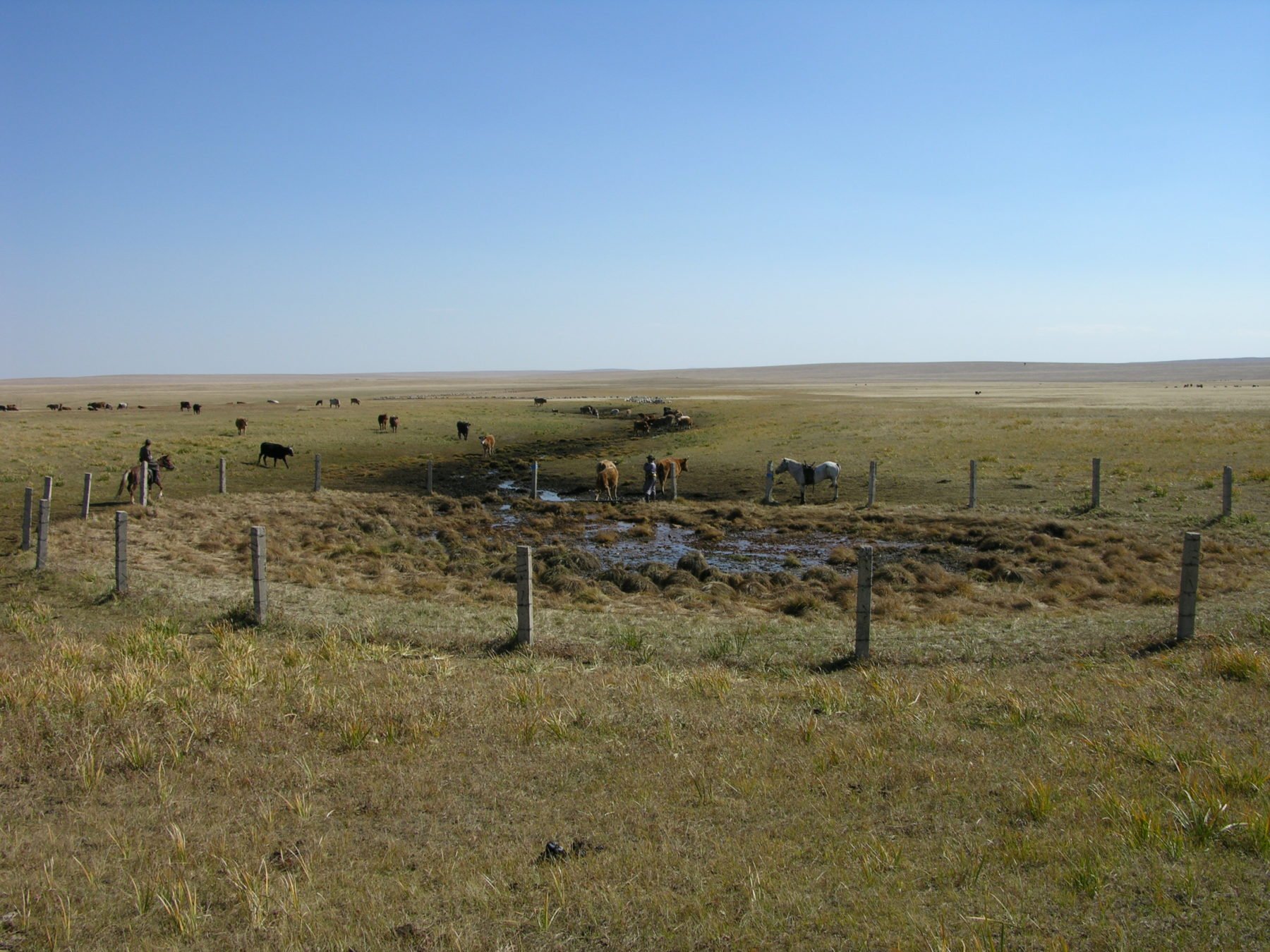
A water source in Toson Hulstay Nature Reserve, Mongolia, in 2010. As the dry phase progresses, livestock depend on these sources of water in Dauria (Image: Vadim Kiriliuk)
Threat of infrastructure projects
The area’s future as a biodiversity hotspot is by no means assured. The Ulz River Basin Management Plan proposes the construction of reservoirs for agriculture and “environmental needs”. It was supported by the United Nations Development Programme and a USD 5.5 million grant from the Adaptation Fund, which finances projects that help developing countries adapt to climate change.
In response, the Russian-Mongolian Environmental Cooperation Commission, which oversees cooperation on agreements regarding environmental protection, stated that maintaining the natural fluctuation of the water cycle is key to preserving the World Heritage Site. Objections to the early damming plans were also voiced at working meetings of Dauria International Protected Area, a 25-year-old trilateral coordination mechanism between China, Russia and Mongolia that brings together research, monitoring, education and other activities for the Darusky, Mogol-Daguur and Hulun (Dalai) protected areas.
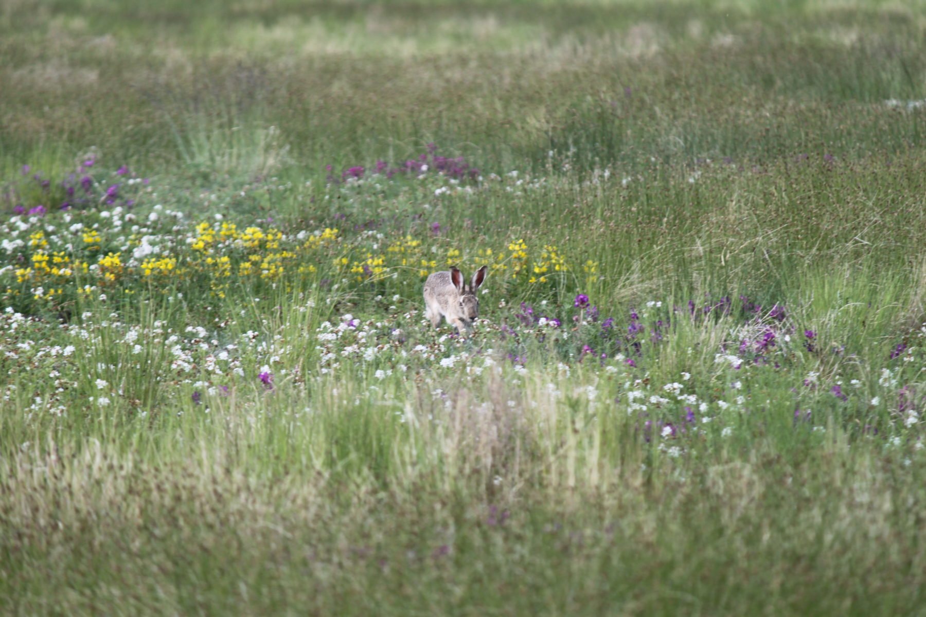
A hare feeds at a meadow in the dry Barun-Torey Lake in 2013. This part of the lake had been dry since at least 2005, allowing sedge and flowering plants to take root. The appearance of certain types of grasses mark transformation of the meadow into a steppe (Image: Tatiana Tkachuk)
RecommendedAnalysis: Mongolia plans ruinous water infrastructure glut
Nevertheless, in 2020 Sh. Myagmar, head of Mongolia’s Water Authority, declared: “The first thing we implement is to restore the flow of the Ulz river, which has been dry over the past decade.” The Ulz is included in the Blue Horse programme: Mongolia’s nationwide masterplan for water infrastructure development.
Locations of dams planned according to the “Blue Horse” Programme and potentially affected natural sites. Note: The Blue Horse programme has not been published. This map is based on a variety of sources and the author’s expertise; it identifies likely potential locations for dams
In summer 2020 construction of a dam across the Ulz river upstream of the World Heritage Site started. The reservoir will hold 27 million cubic metres of water. This is 20% of the river’s average annual flow, and more than five times the annual flow during the dry phase of its cycle. Evaporation from the reservoir could mean 7-9 million cubic metres of water is lost annually, which will deplete the flow significantly in dry years.
The Mongolian government started the construction without notifying neighbouring Russia or submitting a transboundary heritage impact assessment to the UNESCO World Heritage Centre. This violates bilateral treaties and key requirements of the Ramsar and World Heritage conventions. The Third Pole invited the Permanent Delegation of Mongolia to UNESCO to comment on these concerns; a response had not been received till the time of publication.
The project’s stated objective is to support the ecological flow of the Ulz river. But the forces of nature, during the current water-abundant phase of the climate cycle, will restore the flow naturally. This fact was fully recognised in Mongolia’s submission to UNESCO in April 2021.
When the dry phase comes, the dam project may degrade key habitats and prevent the successful reproduction of endangered wetland species, such as the white-naped crane, swan goose and relic gull.
In 2020, the International Union for Conservation of Nature assessed the conservation outlook for the Landscapes of Dauria. It concluded that dam construction on the Ulz river upstream of the site “is potentially a very serious threat to the natural water regime and habitat integrity of key wetlands”. It said an environmental impact assessment is urgently needed.

A shepherd in the Russian steppe in the Landscapes of Dauria. Grazing flocks depend on the availability of water and grass. The dam upstream of the protected area could lead to the earlier drying of the Ulz in the dry phase of the climate cycle. This would worsen conditions for herders during the most critical time when resources are scarce, disrupting the livelihoods of the local population (Image: Anastasia Kiriliuk)

