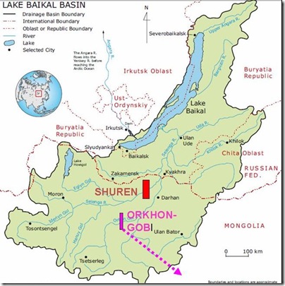
More and more citizen groups, experts, businessmen and other individuals are concerned with a plan to build Shuren Hydro on Selenge River declared by Mongolian Government.
Most people are concerned with environmental damage and consequences for biodiversity, but others are worried about local people and their culture, and some about economic losses for local enterprises. Those people requested from Rivers without Boundaries a map of propose reservoir in order to look whose lands, pastures, fields, buildings and other property will be submerged by the reservoir.
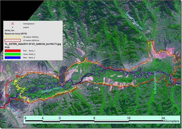
To fulfill this request RwB experts developed a model of reservoir boundary based on public-domain digital elevation model (SRTM) for two levels of reservoir filling most commonly quoted in documents on Shuren Dam: 38 meters (yellow line) and 42 meters (red line). Then both contours were put on the Aster satellite Image from July 1, 2011.
The reservoir seems to be quite large both at 38 and 42 meters high water level ( about 180-205 square kilometers). It will span more than 70 kilometers of river length from the border between Bulgan aimag downstream up to the bridge across Selenge upstream and will be 3- 5 kilometers wide.
The reservoir will drown important pastures and sizable portion of fields used for grain production as could be well seen on the satellite image. It will likely affect territory of 2-3 settlements and, likely, the water-intake system of Erdenet City, which takes its water from under Selenge floodplain.
We posted this image for the benefit of local people, so they can consider possible impacts and losses. We also have reservoir imposed on 2008, 2010 and 2011 images in high-resolution and could send any of those on your request. Please write to us at coalition@riverswithoutboundaries.org
RwB technical expert team


